Aerial mapping, scanning and survey at engineering-grade accuracy.

High-resolution geospatial capture, orthophoto and 3D models for infrastructure, construction, agriculture and defense — delivered as working files, not pretty pictures. Every flight is planned, documented and airspace-approved in advance.

Infrastructure, construction and public-sector teams.
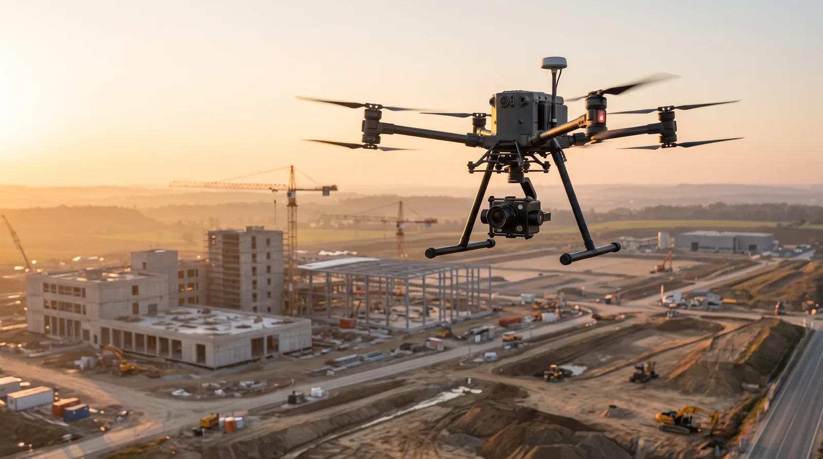
Survey UAV capturing a construction site at first light
±2–3 cmAbsolute accuracy with RTK/PPK and ground control
0.8 cm/pxTypical orthophoto ground sampling distance
12+Years of operational unmanned systems experience
72hTypical turnaround for first deliverables
Coverage
  • Orthophoto & orthomosaic
  • LiDAR & elevation models
  • 3D reality models
  • Volumetrics & quantity take-off
  • Corridor & linear assets
  • Change detection

Why the output survives engineering review

Drone mapping is easy to perform and hard to do correctly. The difference is the accuracy chain — from mission planning to the file that opens in your software.

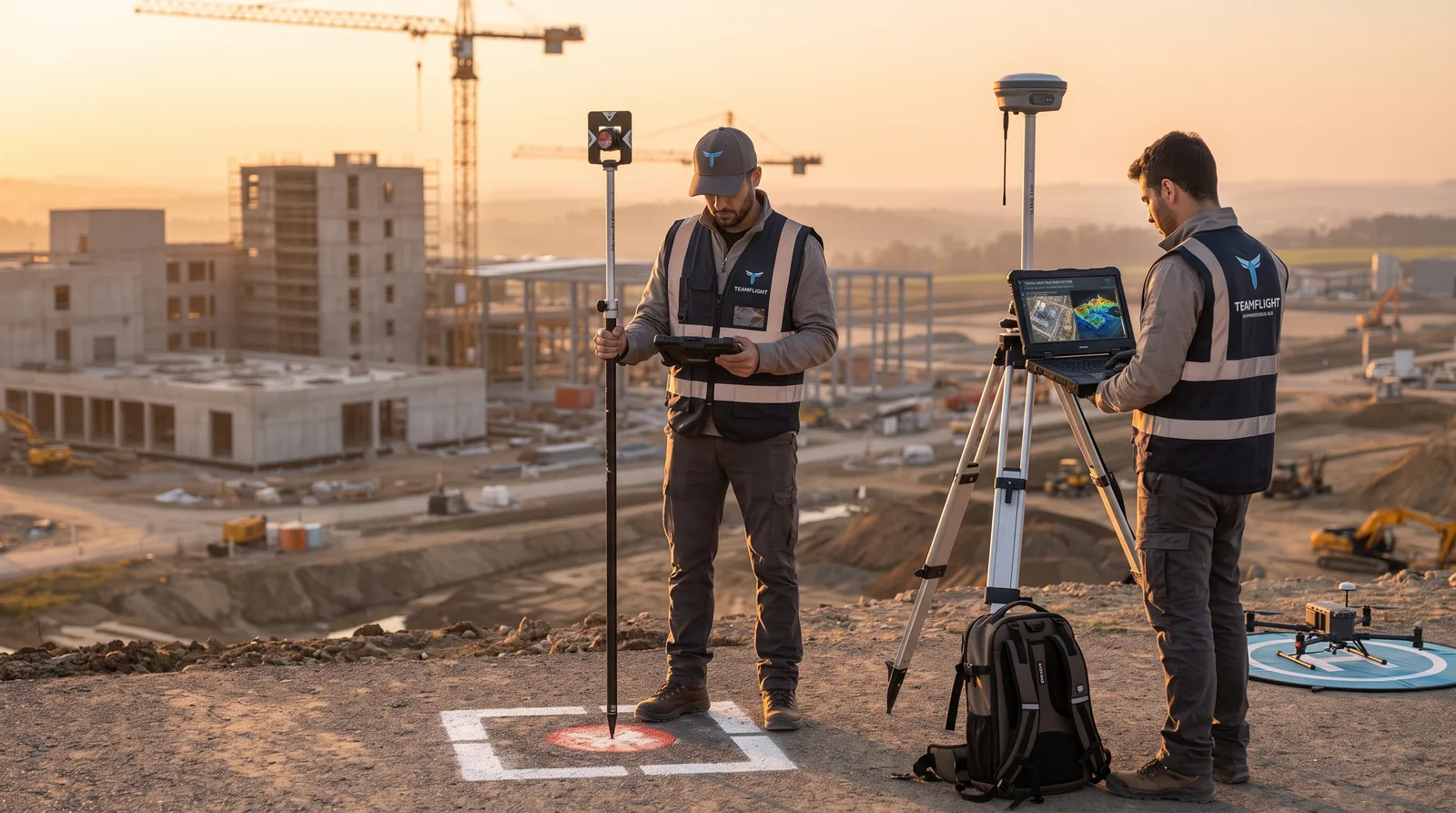
TeamFlight surveyors establishing a ground control point with RTK equipment

Centimetre-level accuracy

RTK/PPK positioning combined with ground control points and independent checkpoints for verification. Every project ships with an accuracy report — not just a claim.

  • ITM / Israeli New Grid, or any required CRS
  • Vertical and horizontal RMSE report
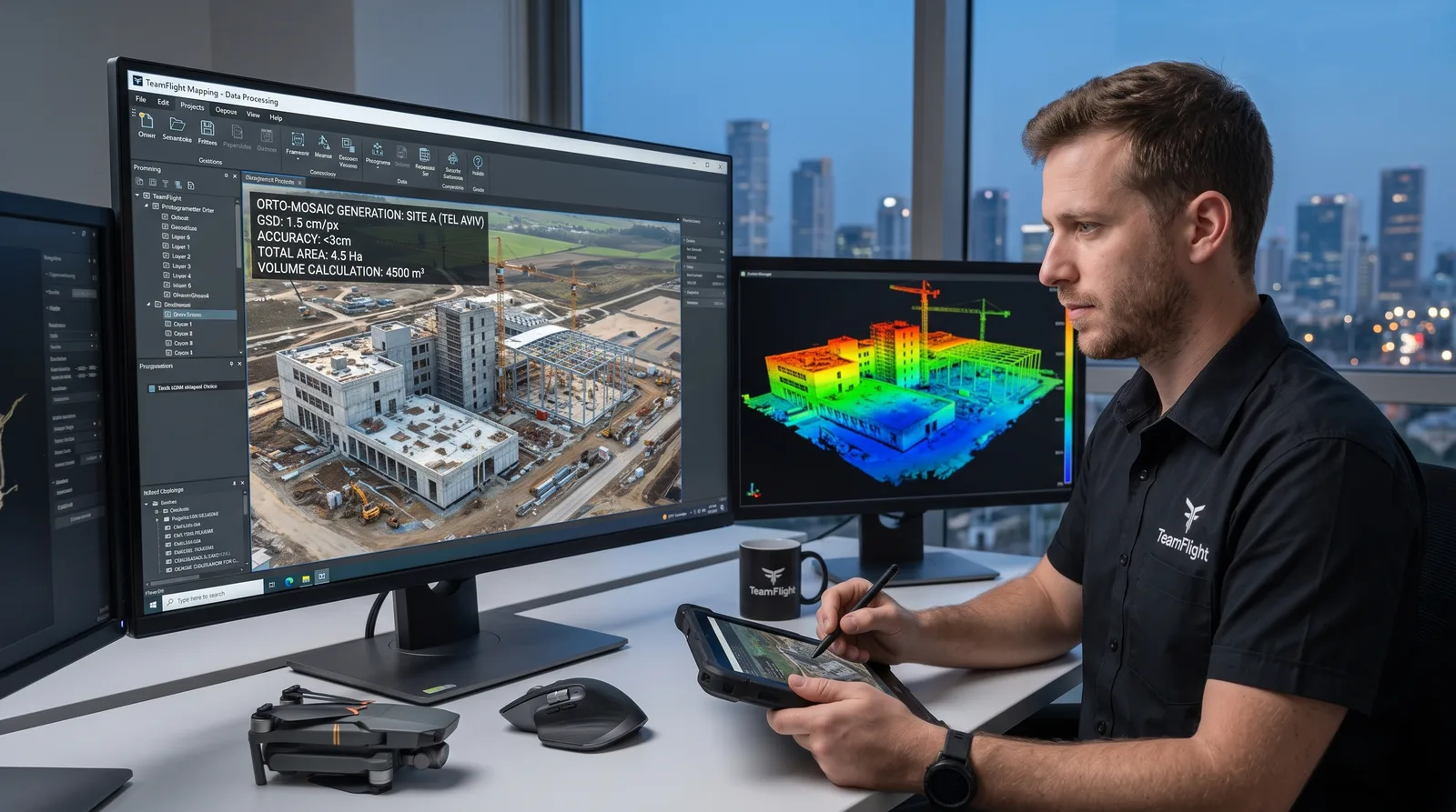
Orthomosaic and classified 3D point cloud under review in processing software

Sensor selection matched to the mission

High-resolution RGB for mapping and models, LiDAR for vegetation penetration and terrain, multispectral for agriculture, thermal for infrastructure and energy inspection.

  • Sensor chosen by required output, not by what's in the case
  • Combined RGB + LiDAR sorties in a single field day
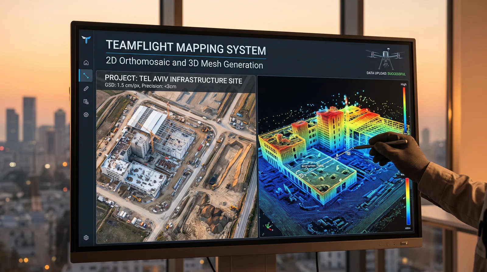
Side-by-side 2D orthomosaic and 3D mesh of an infrastructure site

Files that drop straight into your workflow

Deliverables arrive in the format, coordinate system and layer structure your team already works in — Civil 3D, QGIS, ArcGIS, Revit or your internal GIS platform.

  • Format alignment agreed before the field day
  • Delivery via cloud share or physical drive

Mapping and scanning services

Five service lines. Most of them combine into a single field deployment when the mission justifies it.

  • LiDAR mapping and elevation models

    Airborne laser scanning for vegetation penetration, terrain mapping, slope measurement and volumetrics in open or wooded terrain.

    LAS/LAZ · DEM · DSM · DTM
  • 3D reality models

    Photogrammetric reconstruction of structures, construction sites and complex infrastructure, including oblique passes and façade capture.

    OBJ · FBX · SLPK · 3D Tiles
  • Volumetrics and quantity take-off

    Tracking of quarrying, stockpiles, earthworks and construction progress — including comparison between survey rounds over time.

    Cut/Fill · Contours · CSV · PDF
  • Corridor and linear asset mapping

    Power lines, pipelines, rail and roads — corridor flights with asset-level documentation, clearance analysis and defect detection.

    Asset DB · GeoJSON · targeted imagery

Deliverables specification

Every project ships with a fixed package. No format surprises, no files that need re-translating.

  • The data package

    • Full orthomosaic plus tiled areas
    • Classified point cloud (ground / vegetation / structures)
    • DSM and DTM elevation models
    • Contours at your specified interval
    • Raw geotagged imagery
  • Documentation and QA

    • Accuracy report with horizontal and vertical RMSE against checkpoints
    • Mission report: weather, altitudes, overlap, sensor
    • Flight log and airspace approvals
    • Coordinate reference system and vertical datum definitions

How a project runs

The same discipline we bring to flight test, applied to survey work.

  1. 01

    Mission planning and permits

    Defining objectives and required accuracy, planning flight lines and overlap, checking airspace restrictions, securing approvals and coordinating with the relevant authorities.

  2. 02

    Field deployment and capture

    Ground control layout, operational flying with the selected sensor, and real-time quality control — so problems surface in the field, not after we've left it.

  3. 03

    Processing and photogrammetry

    Point cloud processing, distortion correction, geographic calibration, layer classification and validation against independent checkpoints.

  4. 04

    Delivery and integration

    Files delivered in the format your environment expects, with a short handover call and support on the first load into your system.

Where this gets used

  • Infrastructure and energy

    Power corridor mapping, vegetation clearance checks, facility documentation and route planning — including work with utility operators and their safety standards.

  • Construction and earthworks

    Existing-conditions survey before work begins, monthly progress tracking, cut/fill calculations and comparison against design models.

  • Precision agriculture

    Multispectral vegetation indices, stress-zone detection, plot mapping and irrigation planning — in formats that load into farm management systems.

  • Defense and unmanned systems

    Mapping layers for training, site documentation and 3D models for operational planning — with an operator's understanding of how the data is actually consumed.

  • Municipal and GIS

    Urban layer refresh, existing-conditions capture for planning, building deviation checks and an updated base map for GIS services.

  • UAV manufacturers and startups

    Payload and sensor performance testing, output accuracy validation against ground survey, and operational flying of platforms still in development.

TeamFlight survey UAV on an operational mapping sortie

Who flies it, and why that matters

TeamFlight is run by a certified operator with more than 12 years in civil and military unmanned systems — flight testing, systems integration and operational deployment across Israel, Germany, Brazil, Indonesia, Chile, Uzbekistan and the US. In practice: the person who shows up understands the platform, the sensor, and what your engineering team actually needs at the end of it.

Talk to us about a site

Planning a project that can't afford loose numbers?

Send the site boundary, the accuracy you need and the format you work in — you'll get scope, schedule and a deliverables spec back within one business day.

Book a mapping flight

Questions that come up

Direct answers on accuracy, schedule and permits.

What accuracy can you actually guarantee?

Under reasonable field conditions, with RTK/PPK and proper ground control, typical absolute accuracy is 2–3 cm horizontal and 3–5 cm vertical. Real results depend on vegetation cover, flight altitude and control point density — which is why every delivery includes an RMSE report against checkpoints that were excluded from processing.

How long from flight to files?

For a medium-sized site, first deliverables (orthophoto and elevation model) arrive within roughly 72 hours. Classified point clouds, 3D models and complex quantity calculations usually take 5–7 working days. Rush schedules are possible when agreed in advance.

Who handles flight approvals?

We do. Airspace planning, permit applications and coordination with the relevant authorities are part of the service, not an add-on. Restricted areas and airport proximity require longer lead time, and that's flagged at the quote stage.

Can we get the data in our own coordinate system?

Yes. The default is Israeli Transverse Mercator, but delivery is possible in any CRS and vertical datum you specify, including local project grids. It's worth agreeing on this before the field day, not after.

What happens if weather cancels the field day?

A field day scrubbed for wind, light or visibility moves to the nearest alternative date at no extra charge. The call is made as early as possible so your team doesn't travel for nothing.

Do you also work with drone development teams?

Yes. Beyond mapping services, TeamFlight provides test piloting, systems integration and operational support for unmanned systems developers. If you're building a platform or payload and need validation against ground truth, that's exactly the overlap.